Itinerario ad anello che tocca e attraversa alcune delle numerose frazioni di A loop itinerary that touches and crosses some of the numerous hamlets of Cernobbio, once scattered among cultivated fields and streams and now incorporated into the recent built-up area. Two of them, Piazza Santo Stefano (formerly Piazza) and Rovenna, were until 1929 the capital of the municipalities of the same name, later united with Cernobbio. Taking advantage whenever possible of sections of mule tracks, stairways and old roads, the route winds its way through ancient hamlets, noble residences, hotels and small villas, in a typically sunny and scenic riverside landscape. Only in the highest part, where the large erratic Préa de Bücc stands out, does the urban context briefly give way to the agroforestry context. Easy and within everyone’s reach, it is perfect for those with only half a day to spare
1
The ring of hamlets
Place of departure: Cernobbio Via della Libertà (215m)
Walking time: 1,30 hr approx.
Height difference in ascent: 280m approx.
Maximum altitude: 495m (Punt di Prèzi)
Difficulty: T (tourist)
From the P3 car park in Via della Libertà (215 m), built above the bed of the Greggio Torrent, head uphill along the municipal road to Rovenna.
Admiring the scenic Greggio waterfall on the left, above evident stratifications of the Moltrasio limestone, we turn right and reach the hamlet of Stimianico (CAI 1 signs for the Via dei Monti Lariani).
At the beginning of the hamlet, take the stone steps to the left (Via Parini), which soon join the tarmac Via Monte Grappa (drinking fountain), along which you continue uphill. At the fork that follows, take Via alla Valle Armée to the left, which between high walls leads to the locality Armée (286 m), the point where the Cosera and Colletta streams meet.
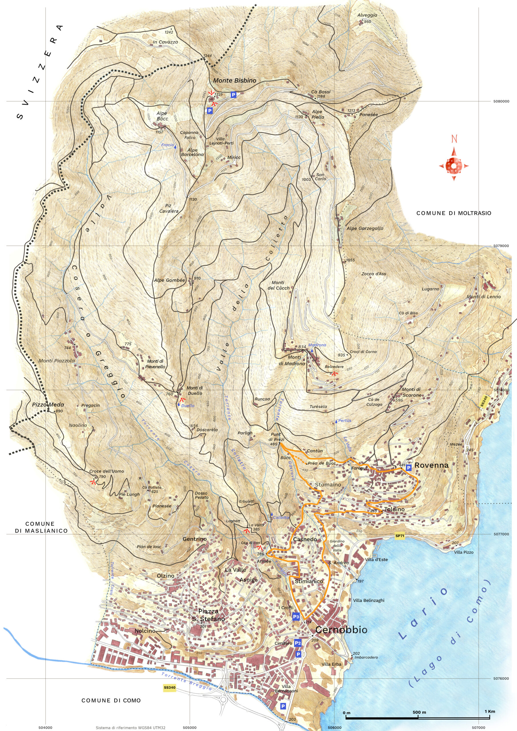
Along the asphalt road, you soon reach Via Noseda, from where you continue right towards Casnedo. he bell tower of the Church of S. Nicola signals us shortly after arriving at the hamlet, as Stimianico is incorporated into the recently built-up area. About halfway through the hamlet, take Via Monte Grappa (CAI trail sign 1) uphill to the left and follow it to the small bridge over the Garrovo stream. ross it and immediately take the old mule track to the left for the hamlet of Stomaino (Via Vecchia), which gathers on a small mountainside. The mule track is followed by a short stretch of asphalt and then, again to the left, by a flight of steps (Via degli scalini), which soon leads to the hamlet (350 m). Reaching the western edge of the village, we pass a small fountain, keep left at the next crossroads and take a small stairway to reach the cobbled Via Pasubio. e follow it uphill to the first hairpin bend, where, at the edge of the village, we leave it for a mule track that enters the forest.
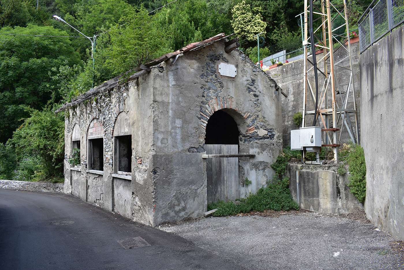
Dry stone walls and small terraces tell us that cultivation was once practised here, as it was on vast areas of the Cernobbio mountains. The young forest that has colonised them conceals a huge random rock, the Préa de Bücc, which is reached by a short detour to the right at the second fork (signposts). The mule track continues uphill touching a rural building, in the locality of Bücc, and then the Punt di Prézi (495 m), where it joins the wider road that connects Parlìgh to Rovenna.
more
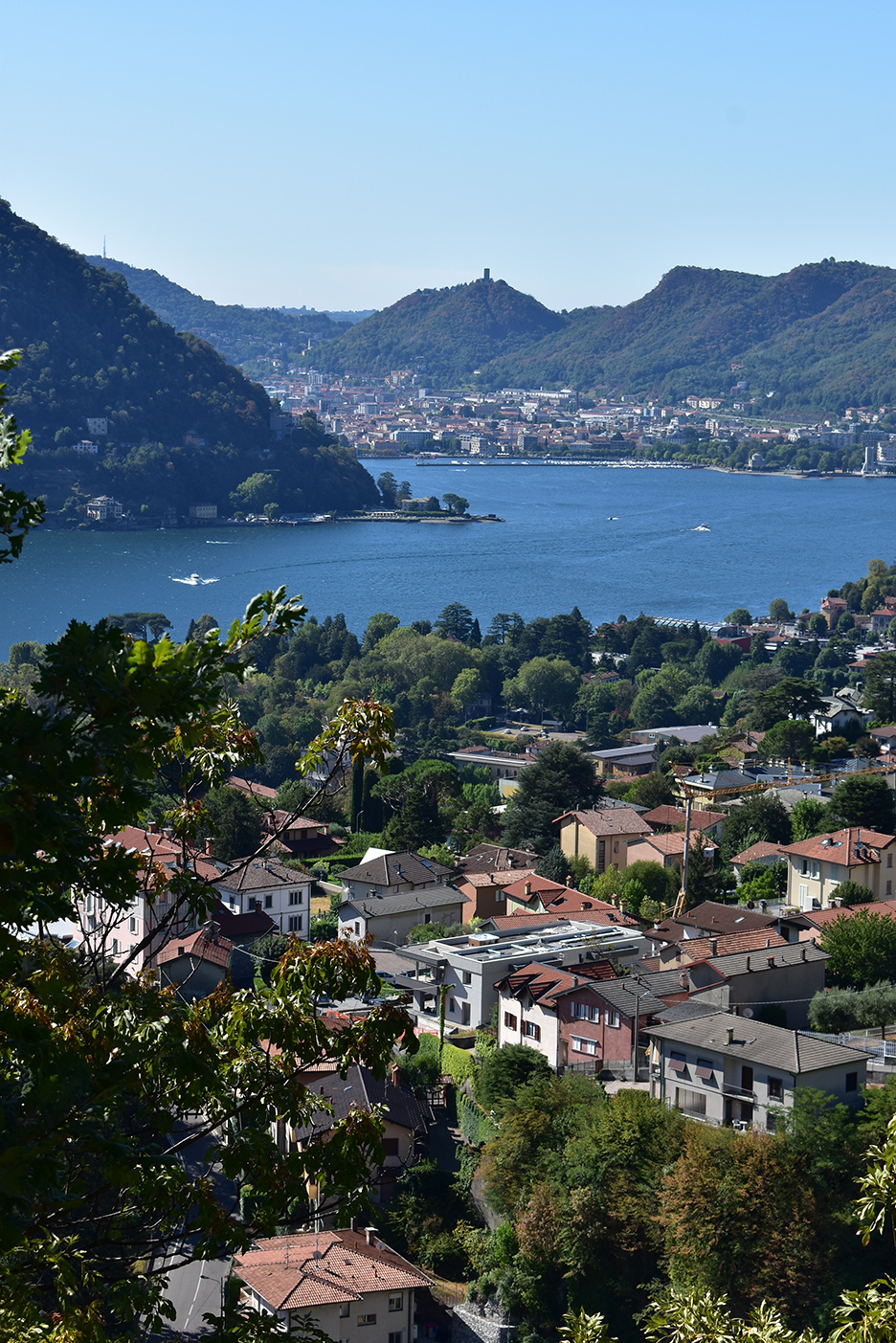
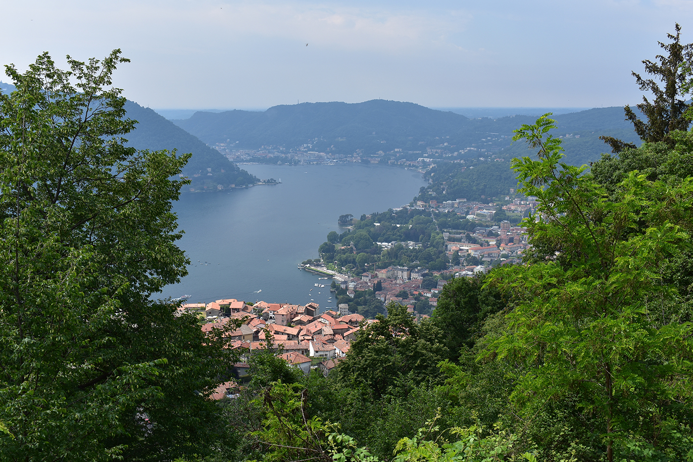
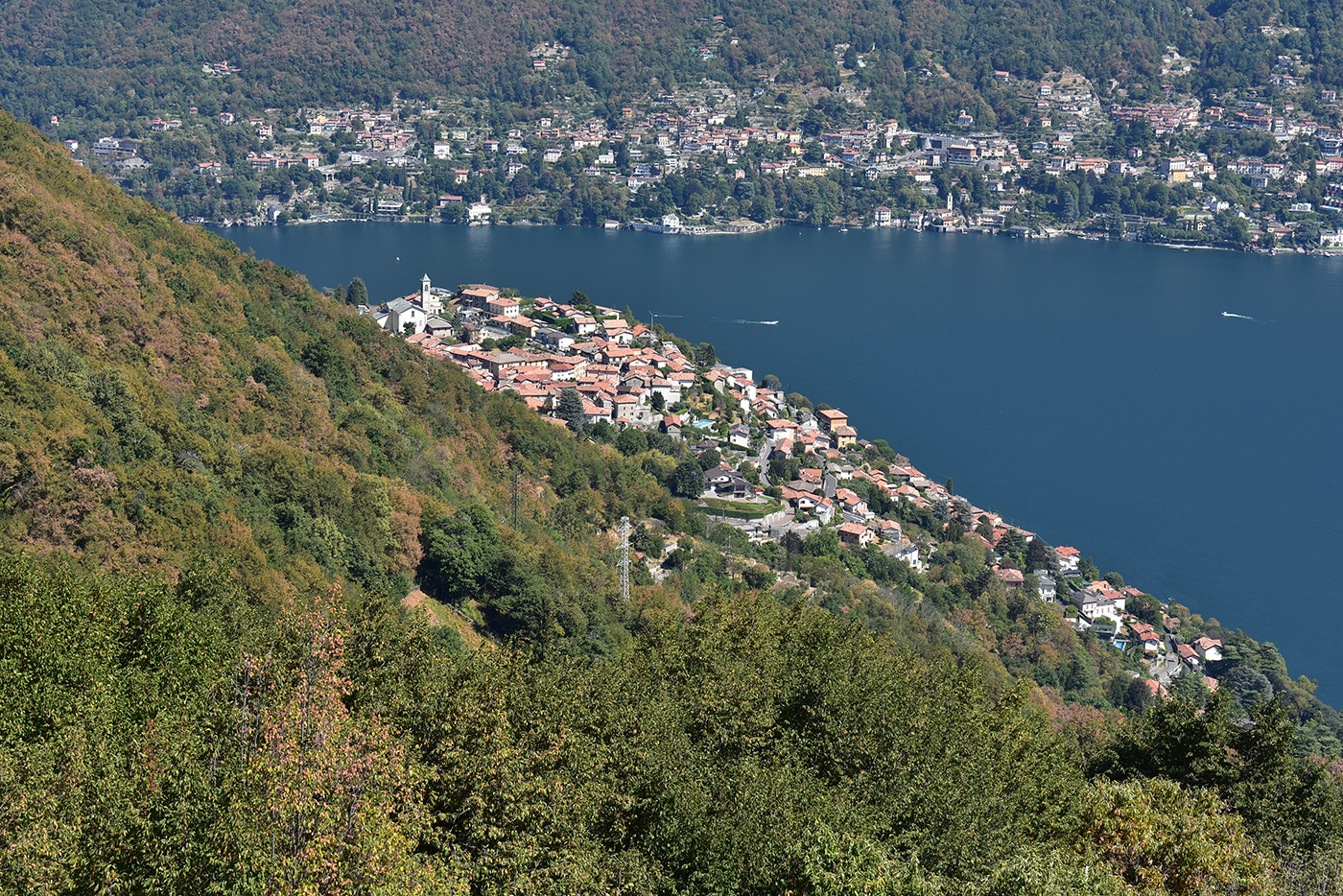
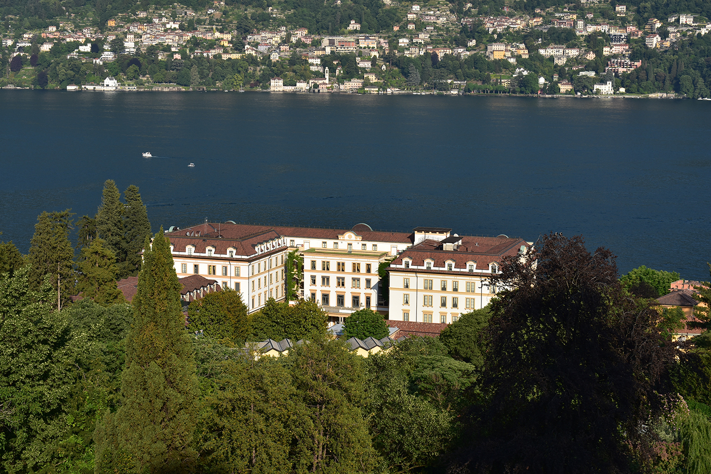
Having reached its highest point, the itinerary begins to descend: on a fine stone track we turn right, touching the Cantùn huts and enjoying beautiful views of the first basin of Lake Como and the town of the same name. Having reached its highest point, the itinerary begins to descend: on a fine stone track we turn right, touching the Cantùn huts and enjoying beautiful views of the first basin of Lake Como and the town of the same name. Having crossed the La Valle stream, which originates from the Pertüs spring, and an old wash-house in ruins, we reach the junction of Farégul, now in Rovenna. Leaving the mule-track on the left that climbs to Monte Bisbino (memorial stone), we take Via Umberto I on the right and cross the old centre, arriving shortly at the parish church of S. Michele (441m). The itinerary now descends to Cernobbio, taking advantage for long stretches of the tranquillity and amenity of ancient and old roads: following Via della Libertà briefly downhill to the right, at the first bend we leave it for Via Monte Santo, which we take to the left. With beautiful views of the western branch of the Lario and its villages, you follow it, crossing the ‘new’ road twice. The second time, follow it briefly as far as the Oratorio della Beata Vergine delle Grazie di Toldino, from where, having crossed it, we take the old road again to the left. We then arrive at the hamlet of Toldino (345 m; fountain), amongst whose old houses we descend a few steps and turn right at the next fork. Still along Via Monte Santo, we pass a bend in the road and cross it twice more, gradually moving westwards. At the second crossroads, near the bridge over the Garrovo Torrent, the ancient road perpendicularly descends the slope, becoming gentler, skirting the Villa d’Este park and then reaching the entrance to the Giardino della Valle. –, che nasce dalla sorgente del Pertüs, e un vecchio lavatoio in rovina, si perviene al bivio della località Farégul, ormai in Rovenna: lasciata a sinistra la mulattiera che sale al Monte Bisbino (cippo in pietra), prendiamo a destra Via Umberto I e attraversiamo l’antico nucleo, pervenendo in breve alla parrocchiale di S. Michele (m 441).
L’itinerario cala ora a Cernobbio, sfruttando per lunghi tratti la tranquillità e l’amenità di antiche e vecchie strade: seguita brevemente a destra, in discesa, Via della Libertà, all’altezza della prima curva la si lascia per Via Monte Santo, che s’imbocca a sinistra. Con belle vedute sul ramo occidentale del Lario e i suoi abitati, la si percorre incrociando due volte la strada “nuova”. Alla seconda la si segue brevemente sino all’Oratorio della Beata Vergine delle Grazie di Toldino, donde, attraversatala, si riprende a sinistra la vecchia via. Giungiamo così alla frazione di Toldino (m 345; fontana), tra le cui appressate e antiche case scendiamo alcuni gradini e teniamo a destra al successivo bivio. Sempre lungo Via Monte Santo sfioriamo un tornante della carrabile e l’attraversiamo altre due volte, portandoci gradualmente verso ovest: al secondo incrocio, nei pressi del ponte sul Torrente Garrovo, l’antica via scende a perpendicolo la pendice, fattasi più dolce, bordando il Parco di Villa d’Este and then reaching the entrance to the Giardino della Valle.. It then touches S. Andrea, now on Via Plinio, and with a gentle bend westwards crosses Via Monte Grappa and finally reaches Via Volta, where at the P3 car park the ring comes to an end.


