2
From Cernobbio to Monte Bisbino along the road to Duello
lungo la strada per Duello
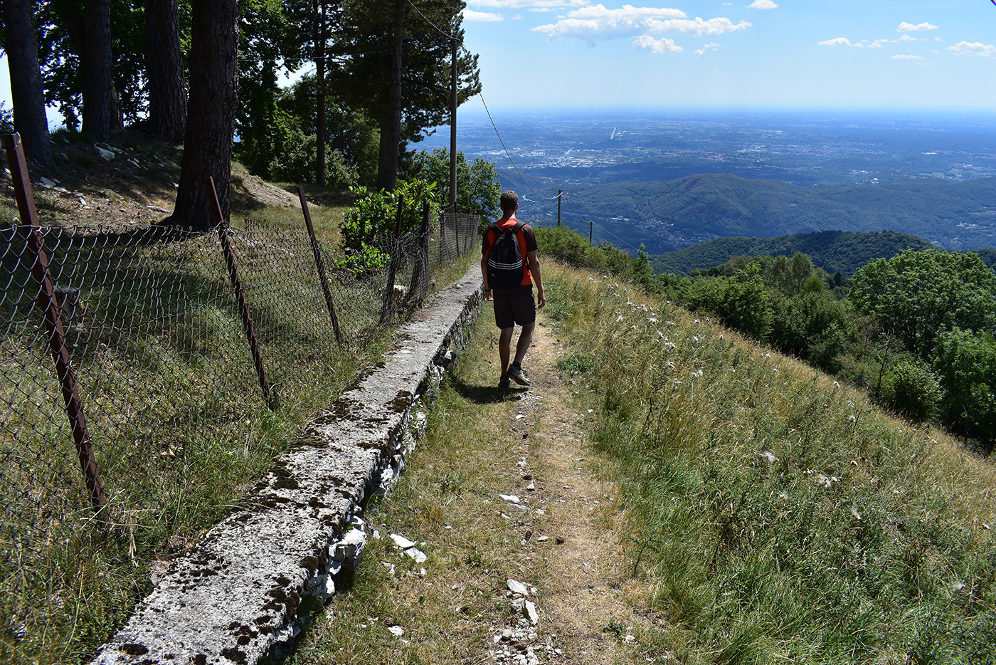
Itinerario lineare che unisce, con percorso diretto e per la quasi totalità lungo la displuviale tra le valli Cosera e Colletta, il centro di Cernobbio (m 215) alla cima del Monte Bisbino (m 1.325). Dopo un primo tratto in contesto urbano, tra la contrada di Stimianico e la località Armée, il tracciato sale deciso e sin quasi alla cima si sviluppa tra gli ampi boschi che rivestono le pendici meridionali della montagna. Tra le poche aperture che accompagnano la salita spicca quella dei Monti di Duello, a circa metà strada, uno dei numerosi “maggenghi” della montagna cernobbiese. Il tratto sommitale si svolge in ambiente aperto, tra i residui pascoli del Bisbino, offrendo ampi panorami in tutte le direzioni. L’amenità dei luoghi, la varietà dei paesaggi attraversati e i tanti spunti offerti dalla cima, tra le fortificazioni della Grande Guerra e il complesso del santuario mariano, costituiscono gli elementi di interesse di questo percorso, facile ma che richiede un minimo di allenamento. Combinato con gli itinerari 1 e 3 permette di realizzare un percorso ad anello di grande interesse escursionistico.
For the starting point and the first part of the route, up to Armée (285 m), see itinerary 1 “The ring of hamlets”.
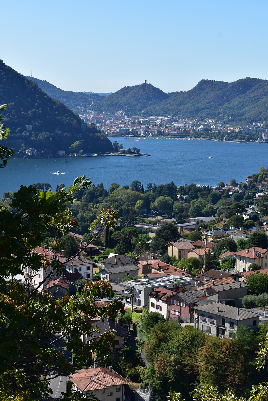
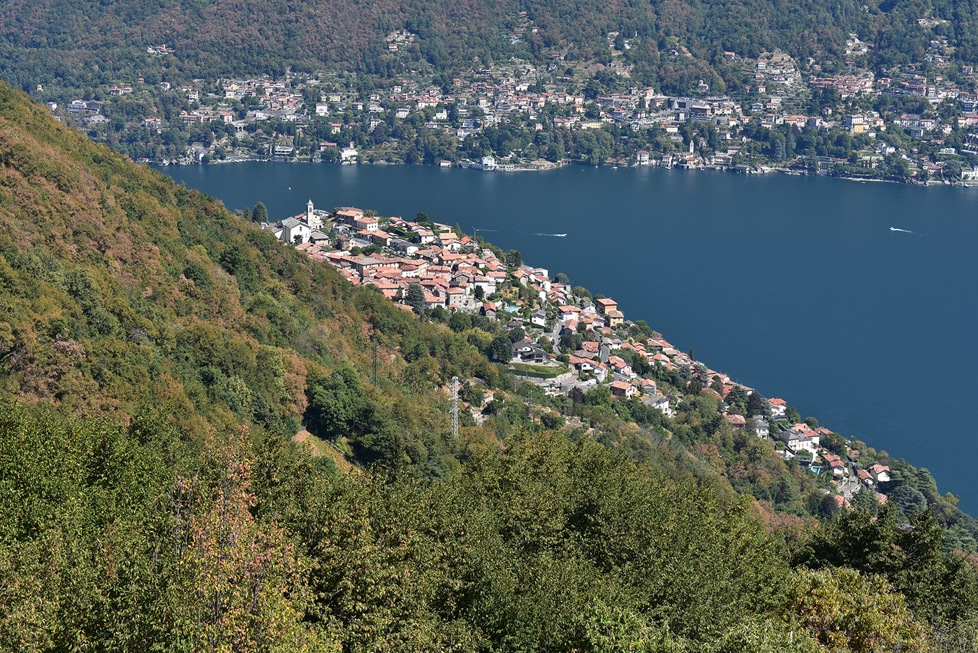
For the starting point and the first part of the route, as far as Armée (286 m), see itinerary 1 “The hamlets ring”. Having reached Armée, where the Cosera and Colletta streams meet, we head eastwards to the junction of Via Noseda and Valle Armée. Along the latter we continue northwards, crossing the Colletta stream and leaving the village. The road, now with a stone surface, passes behind a house and immediately climbs steeply into a sparse forest dominated by thermophilic species, i.e. those that love warm environments, such as the black hornbeam and manna ash. Some boulders of alpine origin and local moraine outcrops reveal the ancient presence of the Adda Glacier, which profoundly shaped the area in the Quaternary period. Some clearings, and in particular the one at La Volta (385m), where you leave the path to Laghétt on the left, offer beautiful views of the Lario and the city of Como, and the opportunity for a short break. Lungo quest’ultima proseguiamo verso nord, scavalcando il Torrente Colletta ed uscendo dall’abitato. La strada, ora con fondo in pietra, retropassa una casa e subito sale decisa in un bosco rado ove dominano specie termofile, cioè amanti degli ambienti caldi, quali carpino nero e orniello. Alcuni massi di provenienza alpina e locali affioramenti morenici rivelano l’antica presenza del Ghiacciaio dell’Adda, che nel Quaternario plasmò profondamente l’area. Alcune radure, e in particolare quella in località La Volta (m 385), ove si lascia sulla sinistra il sentiero per il Laghétt, offrono belle viste sul Lario e sulla città di Como e l’occasione per una breve sosta.
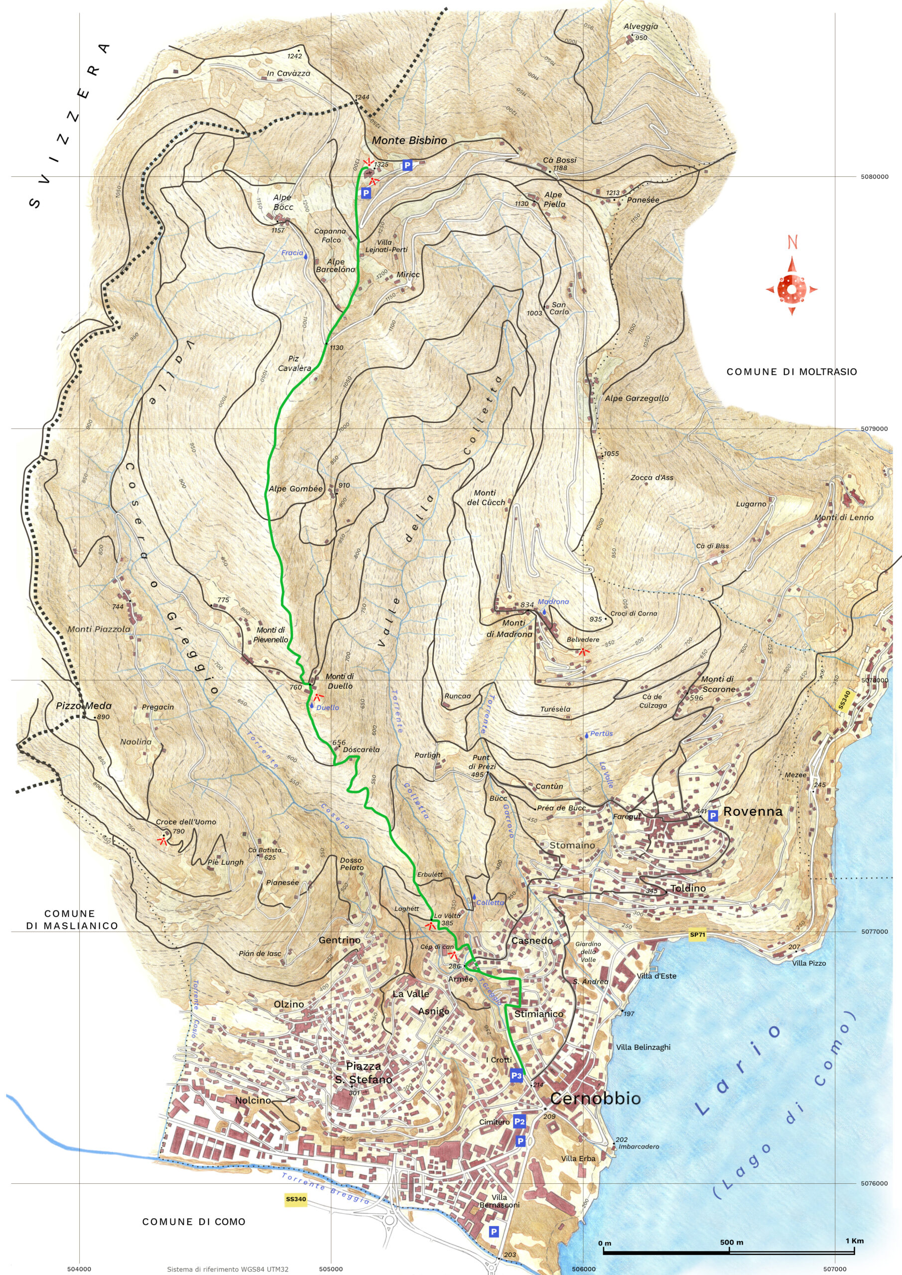
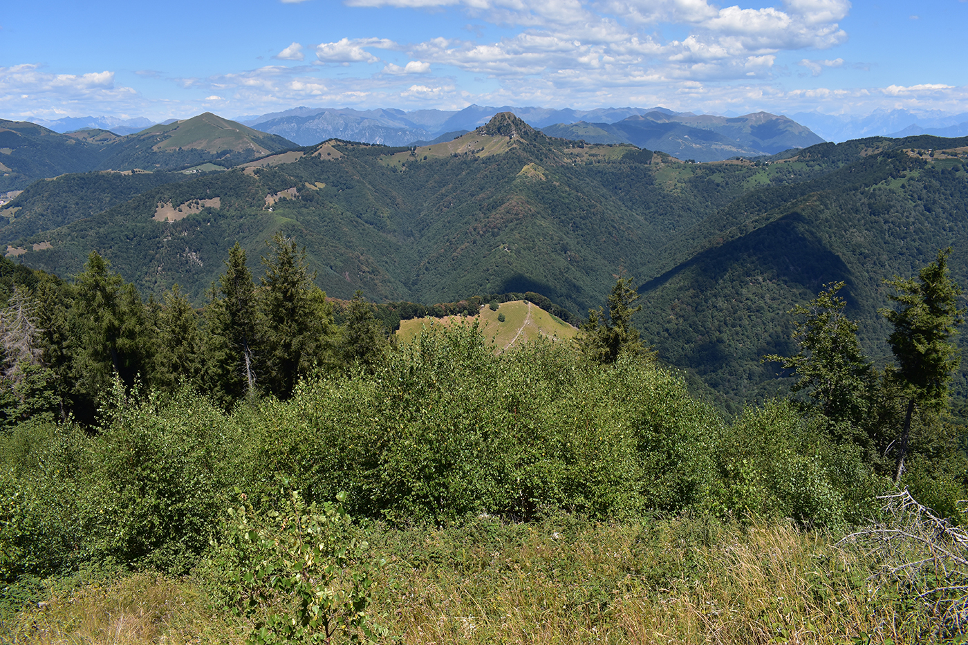
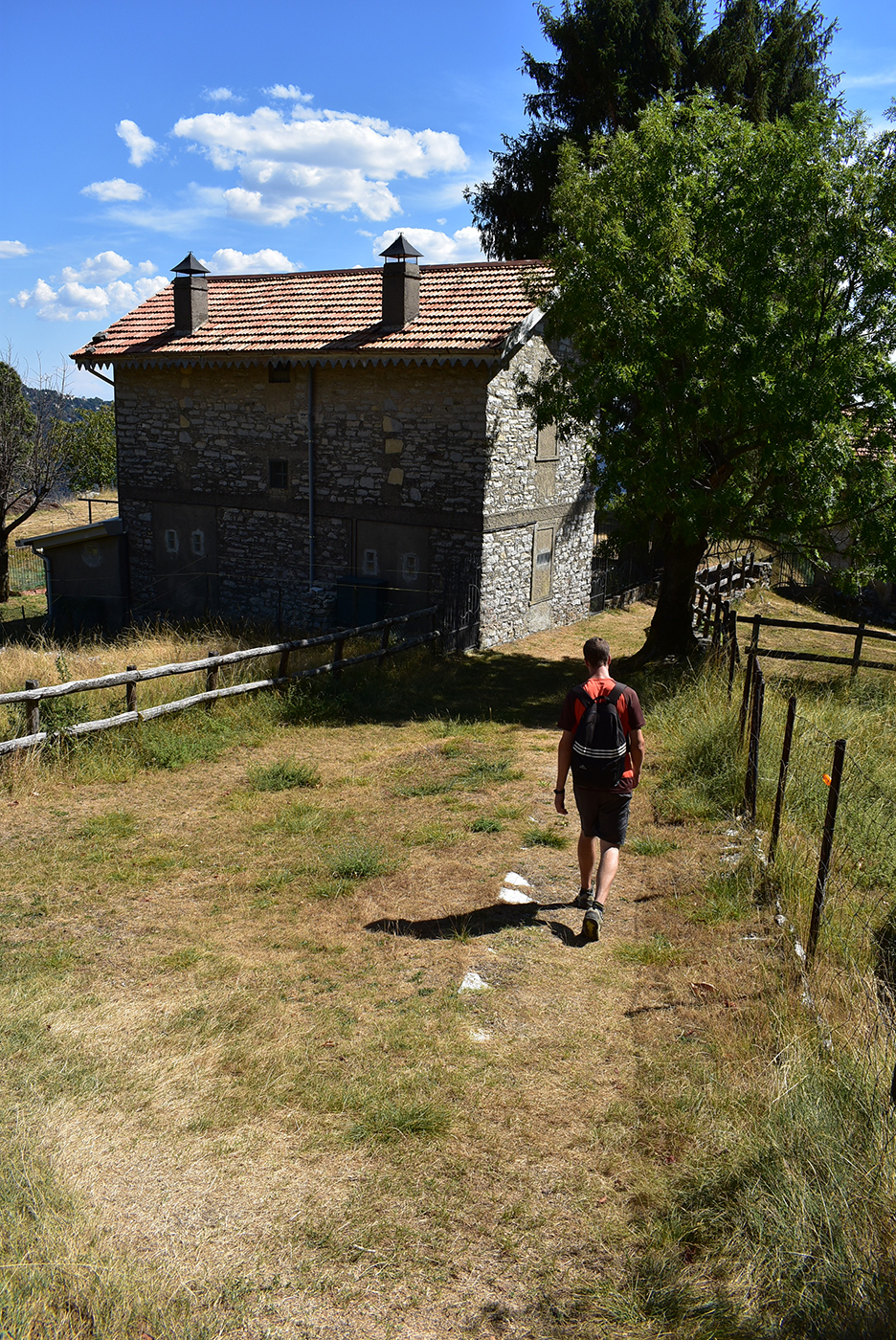
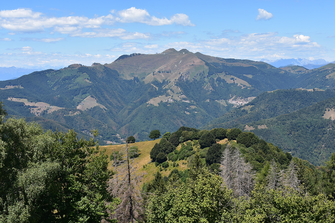
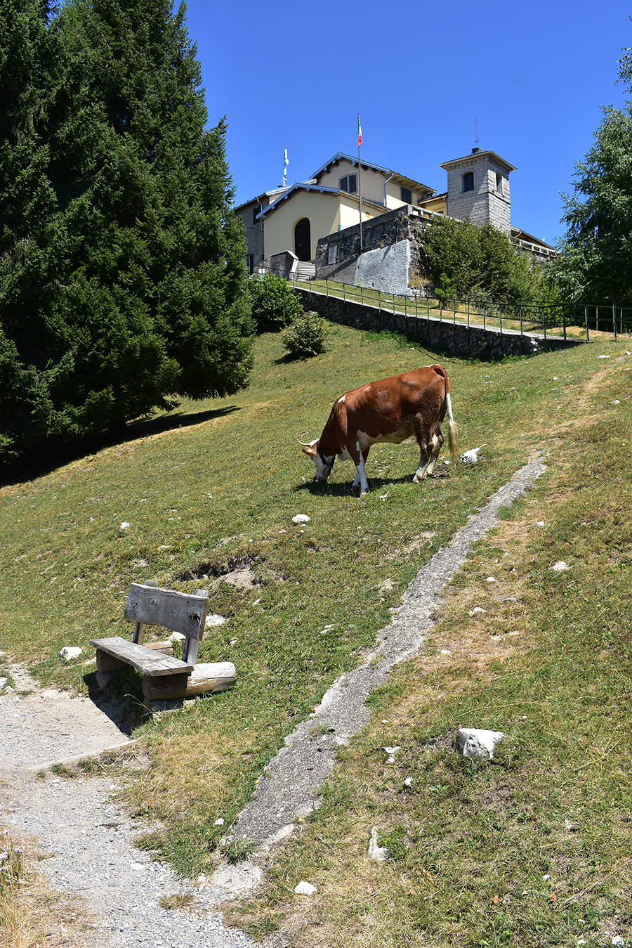
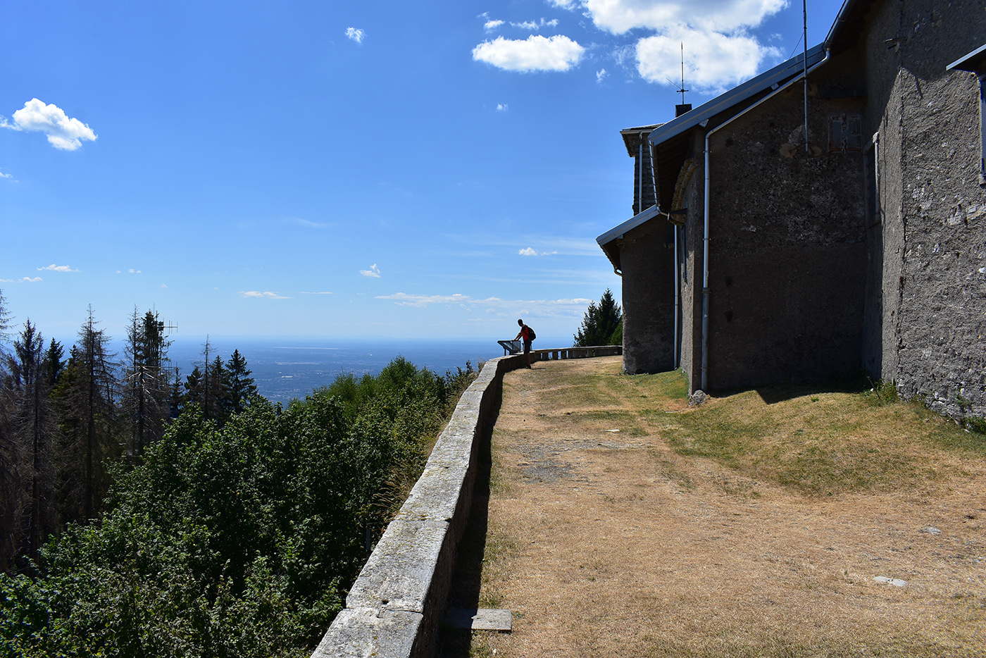
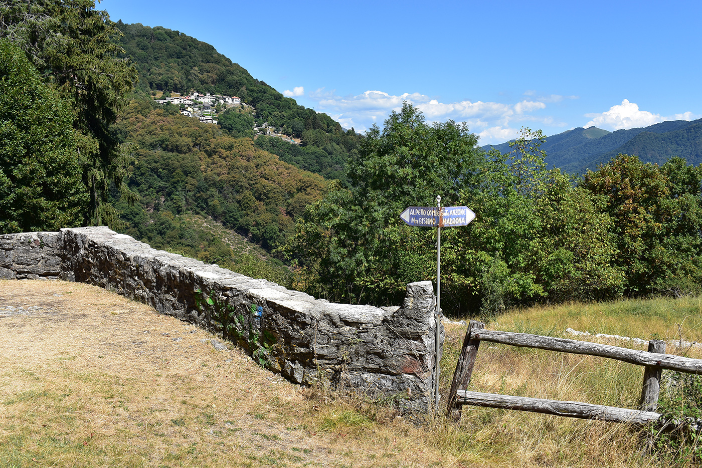
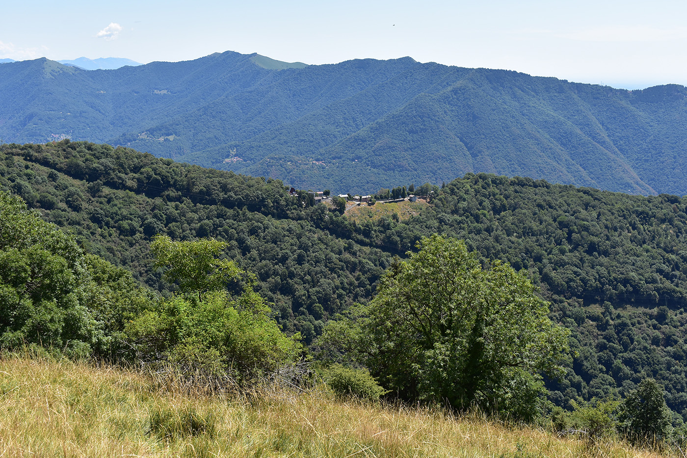
Beyond a power line, you reach Èrbulétt, a place-name that refers to the presence of chestnut trees, where, to the right, the trail descends to Colletta. Still on a beautiful mule track, the importance of which is revealed by the width and care with which it was built, we ascend along the watershed to a new fork in the road at Dóscarèla: leaving the road for Pievenello on the left, we continue straight ahead and soon reach the spring and then the meadows and houses of Duello (760 m), one of the numerous “monti” where livestock used to summer. Having enjoyed the beautiful panorama, we start to climb again, now along the Strada de la còsta, which is a very significant point. At the crossroads between the houses, go left, towards Pievenello, and then turn right at the nearby shrine and follow a track that has taken on the appearance of a simple path. Characteristic stratified outcrops of Moltrasio limestone accompany the ascent, which continues through the woods along the watershed line. At the crossroads you come to, including the one for Alpe Gombée, continue straight on, towards the Bisbino peak. After a short digression along the western slope of the mountain, the path rejoins the watershed just beyond Piz Cavalèra, where some Great War trenches appear. In fact, Monte Bisbino was the southern stronghold of the Northern Frontier in the Lario Intelvese area, an articulated and discontinuous line of defence placed to protect the national border between Val d’Aosta and Stelvio. The itinerary continues along the ridge, crossing the road that on the left reaches Alpe Böcc (m 1,140) and then crossing the remains of the Bisbino pastures, today restricted by reforestation and the natural expansion of the forest but once extended to the entire summit of the mountain. Having passed Villa Lejnati Perti and left the small road to the Capanna Falco on the left, we touch a hairpin bend of the carriageway coming from Rovenna and then reach its junction, at the foot of the Sanctuary of the Madonna del Bisbino. A last short stretch leads to the Aprica peak (1,325 m), where the vast views are accompanied by the possibility of a pleasant refreshment at the small refuge, a place with an ancient tradition of hospitality. Sempre su bella mulattiera, la cui importanza è rivelata dall’ampiezza e dalla cura con cui fu realizzata, si sale lungo la displuviale, sino a un nuovo bivio, in località Dóscarèla: lasciata sulla sinistra la strada per Pievenello, si seguita diritti e in breve si raggiungono la sorgente e poi i prati e le case di Duello (m 760), uno dei numerosi “monti” ove un tempo si trasferiva il fulcro dell’attività contadina dalla primavera all’autunno. Goduto del bel panorama, si riprende a salire, ora lungo la Strada de la còsta, dal chiarissimo significato. Al bivio tra le case si va a sinistra, verso Pievenello, per poi piegare a destra alla vicina santella e seguire un tracciato con fattezze di semplice sentiero.
Caratteristici affioramenti stratificati del Calcare di Moltrasio accompagnano la salita, che continua nel bosco lungo la linea spartiacque. Ai bivi che si incontrano, tra cui quello per l’Alpe Gombée, si prosegue diritti, verso la cima del Bisbino. Dopo una breve digressione lungo il versante occidentale della montagna, il sentiero recupera la displuviale poco oltre il Piz Cavalèra, laddove compaiono alcuni camminamenti della Grande Guerra.
more
Il Monte Bisbino costituì infatti il caposaldo meridionale della Frontiera Nord nel Lario Intelvese, un’articolata e discontinua linea difensiva posta a protezione del confine nazionale tra la Val d’Aosta e lo Stelvio.
L’itinerario continua lungo il crinale incrociando la strada che a sinistra raggiunge l’Alpe Böcc (m 1.140) e poi attraversando i resti dei pascoli del Bisbino, oggi ristretti dai rimboschimenti e dall’espansione naturale del bosco ma un tempo estesi all’intera sommità del monte. Fiancheggiata Villa Lejnati-Perti e lasciata sulla sinistra la stradella per la Capanna Falco, si tocca un tornante della carrabile proveniente da Rovenna e poi se ne raggiunge l’attestamento, ai piedi del Santuario della Madonna del Bisbino. Un ultimo breve tratto porta sull’aprica cima (m 1.325), ove ai vasti panorami si accompagna la possibilità di un piacevole ristoro al piccolo rifugio, erede di un’antica tradizione d’ospitalità.


